Weather School
Nine levels from cloud spotting to reading the sea state and decoding the Shipping Forecast against the clock. Earn stars to unlock the next level and climb from Landlubber to Weather Guru. Covers the meteorology in the Day Skipper and Yachtmaster theory syllabus. For quick reference, see the weather tools.
The ten cloud types every sailor should know
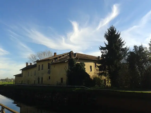 Cirrus (high): Thin white wisps and hooked streaks, often called mares' tails. Often the first sign of a warm front 12 to 24 hours away, especially when it thickens and spreads across the sky.
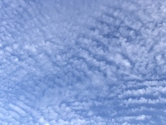 Cirrocumulus (high): Tiny white ripples or grains in rows, like fish scales. Usually short-lived and harmless, but in a thickening sequence of high cloud it can mean a front is coming.
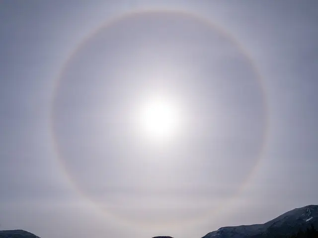 Cirrostratus (high): A thin milky veil that makes a halo round the sun or moon. The classic halo: a warm front is likely within about 12 to 24 hours. Expect the wind to back and freshen.
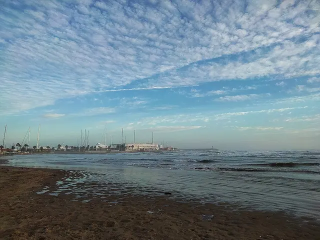 Altocumulus (middle): Grey-white rounded heaps in patches or rolls, larger than cirrocumulus. Mostly fair. If it shows towers (castellanus) on a warm summer morning, thunderstorms may follow later in the day.
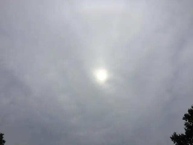 Altostratus (middle): A grey sheet; the sun looks like it is behind frosted glass, with no halo. The warm front is getting close. Rain likely within a few hours; the barometer will be falling.
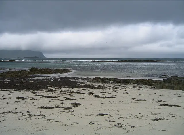 Nimbostratus (low): A thick, dark, featureless layer with steady rain or snow. You are at or near the warm front: continuous rain, poor visibility and fresh to strong winds.
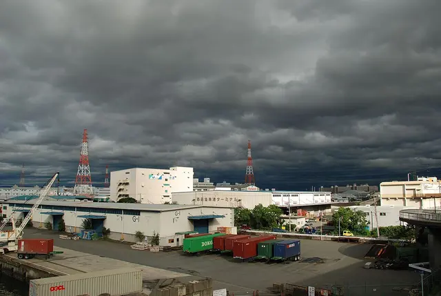 Stratocumulus (low): Low lumpy grey rolls or patches, often with gaps of blue. Common and usually dry, with moderate winds. Typical of the edge of a high.
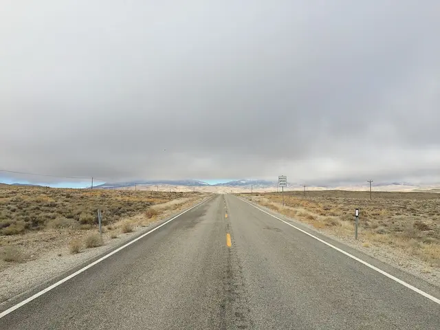 Stratus (low): A low, flat, grey layer hiding hilltops; drizzle at most. Typical of the warm sector or lifted sea fog. Poor visibility and drizzle.
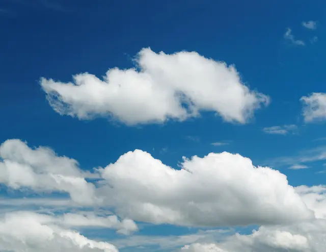 Cumulus (vertical): Detached white puffs with flat bases and cauliflower tops. Fair weather when small. Building cumulus brings showers and gusts; they mark sea breezes and the cool air behind cold fronts.
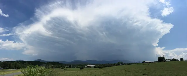 Cumulonimbus (vertical): A huge towering cloud with a flat, spreading anvil top. Squalls, heavy showers, hail, thunder and sudden wind shifts. Reef before it reaches you.
How a depression passes
In the northern hemisphere most bad weather arrives with depressions moving from west to east. Ahead of the warm front, high cloud thickens (cirrus, cirrostratus, altostratus), the barometer falls and the wind backs and freshens. Rain sets in at the warm front and the wind veers. The warm sector is mild and murky with a steady barometer. The cold front brings a sharp veer, squalls and a drop in temperature, then the barometer rises and the air clears, with showers.
Reading a synoptic chart
Isobars join points of equal pressure. The closer together they are, the stronger the wind. Wind blows anticlockwise around a low and clockwise around a high in the northern hemisphere, angled about 15° in towards the low over the sea and more over land. Buys Ballot’s law: stand with your back to the wind and the low is on your left.
Photo credits
Cloud photographs from Wikimedia Commons, resized and converted to WebP. Each is used under the licence shown.
- Cirrus: 20141118 abies.jpg by Fontema, CC BY-SA 4.0
- Cirrocumulus: 2021-11-27 15 52 16 Cirrocumulus "Mackeral sky" above the Franklin Farm section of Oak Hill, Fairfax County, Virginia.jpg by Famartin, CC BY-SA 4.0
- Cirrostratus: Solar Halo Feb 13 2021.jpg by Mitchell Underwood, CC BY-SA 4.0
- Altocumulus: 133 Platja de Ribes Roges (Vilanova i la Geltrú), al fons els edificis del port.jpg by Enric, CC BY 4.0
- Altostratus: 2017-06-22 16 57 51 Sun shining dimly through an altostratus cloud layer over Ladybank Lane in the Chantilly Highlands section of Oak Hill, Fairfax County, Virginia.jpg by Famartin, CC BY-SA 4.0
- Nimbostratus: Flakstad 2005-07-07.jpg by ZorroIII, CC BY-SA 3.0
- Stratocumulus: 4 Chome Nankōhigashi, Suminoe-ku, Ōsaka-shi, Ōsaka-fu 559-0031, Japan - panoramio - jetsun.jpg by jetsun, CC BY-SA 3.0
- Stratus: 2015-01-14 11 43 55 View north under some low clouds along Nevada State Route 487 (Baker Road) north of Baker, Nevada.JPG by Famartin, CC BY-SA 4.0
- Cumulus: 2013-05-19 15-03-51-nuages.jpg by Thomas Bresson, CC BY 3.0
- Cumulonimbus: 2016-07-19 14 30 41 Thundestorm with a large cumulonimbus anvil and mammatus hanging from it over the Blue Ridge Mountains of Shenandoah National Park, viewed from U.S. Route 211 (Lee Highway) just east of Collins Avenue in Luray, Virginia.jpg by Famartin, CC BY-SA 4.0
Embed this weather school game on your site
Free for sailing clubs, schools and blogs. Paste this into your page; it works on any site that allows HTML.
<iframe src="https://learntosail.io/embed/weather-school" title="Weather School game" width="100%" height="1100" loading="lazy" style="border:1px solid #d8dee4;border-radius:8px;max-width:100%"></iframe>
<p style="font-size:13px">Free <a href="https://learntosail.io/tools/weather-school">weather school game</a> from learntosail.io</p>