Tidal streams
What Is a Tidal Stream Atlas and How Do You Use It?
Published · Last checked October 2026
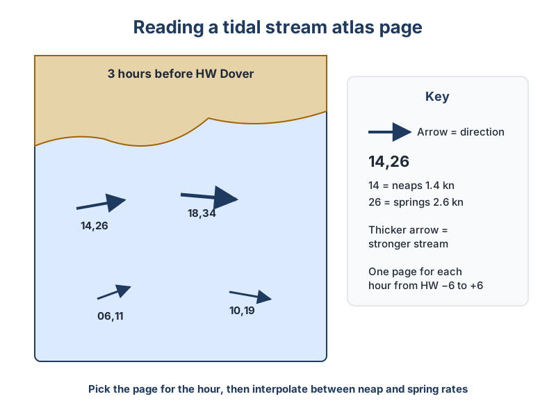
A tidal stream atlas is a set of hourly chartlets showing the direction and rate of tidal streams for an area, from six hours before to six hours after high water at a reference port such as Dover. Arrows show direction; figures like 14,26 give the neap and spring rates in tenths of a knot (1.4 and 2.6 knots). Sailors use it to plan passage timing and to work out tidal set and rate for a course to steer.
How an atlas is laid out
Each page covers one hour relative to high water at the reference port, labelled for example '3 hours before HW Dover'. The UKHO publishes atlases for UK waters, and almanacs reproduce simplified versions. Arrows show the direction the stream is flowing towards; thicker arrows indicate stronger streams.
| Figure on page | Neap rate | Spring rate |
|---|---|---|
| 08,15 | 0.8 kn | 1.5 kn |
| 14,26 | 1.4 kn | 2.6 kn |
| 21,40 | 2.1 kn | 4.0 kn |
Using it step by step
- Find the time of HW at the atlas's reference port for your day.
- Write the clock time against each page (HW−6 to HW+6), remembering BST.
- Decide whether it is springs, neaps or in between, using the range of the day compared with mean spring and neap ranges.
- Interpolate the rate: if the day's range is halfway between neap and spring, take a rate halfway between the two figures. Most atlases include a graph for this.
- Read the direction and rate at your position for each hour of the passage.
Atlas or tidal diamonds?
Charts also carry tidal diamonds, which give precise figures at specific points. The atlas gives the big picture: where eddies form, where streams run hardest off headlands, and when they turn along a coast. Many navigators use the atlas for planning and the nearest diamond for detailed chartwork.
- Use it to time your departure so the stream helps you through headlands and tidal gates.
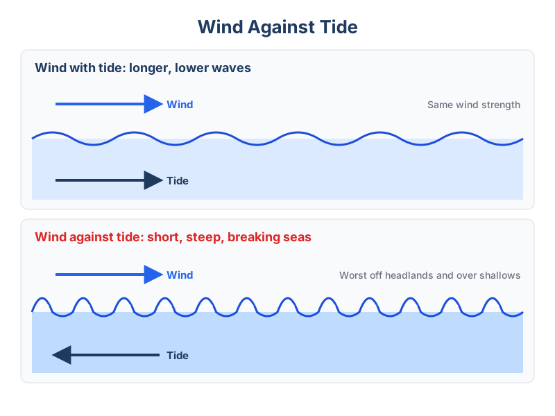
- Spot periods of wind against tide, which raise steep, dangerous seas.
- Find slack water for crossing busy channels or entering harbours.
Learn more in the tidal chartwork lesson.