Tides
What Is Height of Tide? Meaning and How to Find It
Published · Last checked October 2026
Height of tide is the vertical distance from chart datum up to the sea surface at a particular moment. Tide tables give it at high and low water; between those times you find it with a tidal curve or the rule of twelfths. It is not the depth: depth of water is charted depth plus height of tide. Nor is it the range, which is the difference between consecutive high and low water heights.
Height, depth and range
These three terms are often mixed up, and mixing them up is how boats go aground.
| Term | Definition | Example |
|---|---|---|
| Height of tide | Sea level above chart datum now | 2.8 m |
| Charted depth | Seabed below chart datum | 1.5 m |
| Depth of water | Charted depth + height of tide | 4.3 m |
| Range | HW height − LW height | 4.9 m − 0.8 m = 4.1 m |
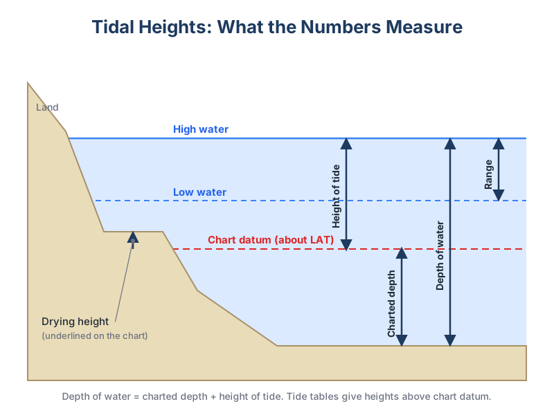
Finding the height of tide
- Look up the times and heights of high and low water for the standard port (or a secondary port, after corrections).
- Work out how long before or after high water your time is.
- Use the port's tidal curve: mark the HW and LW heights, enter at your time and read off the height. Or use the rule of twelfths for a quick estimate.
- Adjust for weather if necessary: high pressure lowers the level, low pressure and onshore gales raise it.
The rule of twelfths assumes the tide rises 1, 2, 3, 3, 2, 1 twelfths of the range in each hour of a roughly six-hour rise. It is good enough for many places but poor where tides are irregular, such as the Solent, where you should use the curve.
Springs, neaps and the weather
Heights vary through the lunar cycle. At spring tides high waters are higher and low waters lower; at neaps the range is smaller. As a rough guide, each millibar of pressure difference from average shifts sea level by about a centimetre, so a deep low can add tens of centimetres. Storm surges can add much more.