Electronics
How to Use Radar on a Boat: Beginner's Guide
Published · Last checked October 2026
To use radar on a boat: switch on and transmit, pick a medium range (3 to 6 miles), turn the gain up until a light speckle just shows, check the tune, then add just enough sea clutter control to clear waves near the centre, and rain clutter only in showers. Measure range with the VRM and bearing with the EBL, and watch each target: a steady bearing with a closing range means risk of collision.
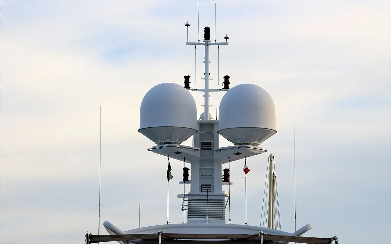
What is marine radar used for?
- Collision avoidance in fog, at night and in poor visibility (COLREGs Rule 7 requires proper use of radar if you have it).
- Position fixing from radar ranges of headlands and charted features.
- Pilotage into harbours in poor visibility.
- Spotting squalls and rain showers before they reach you.
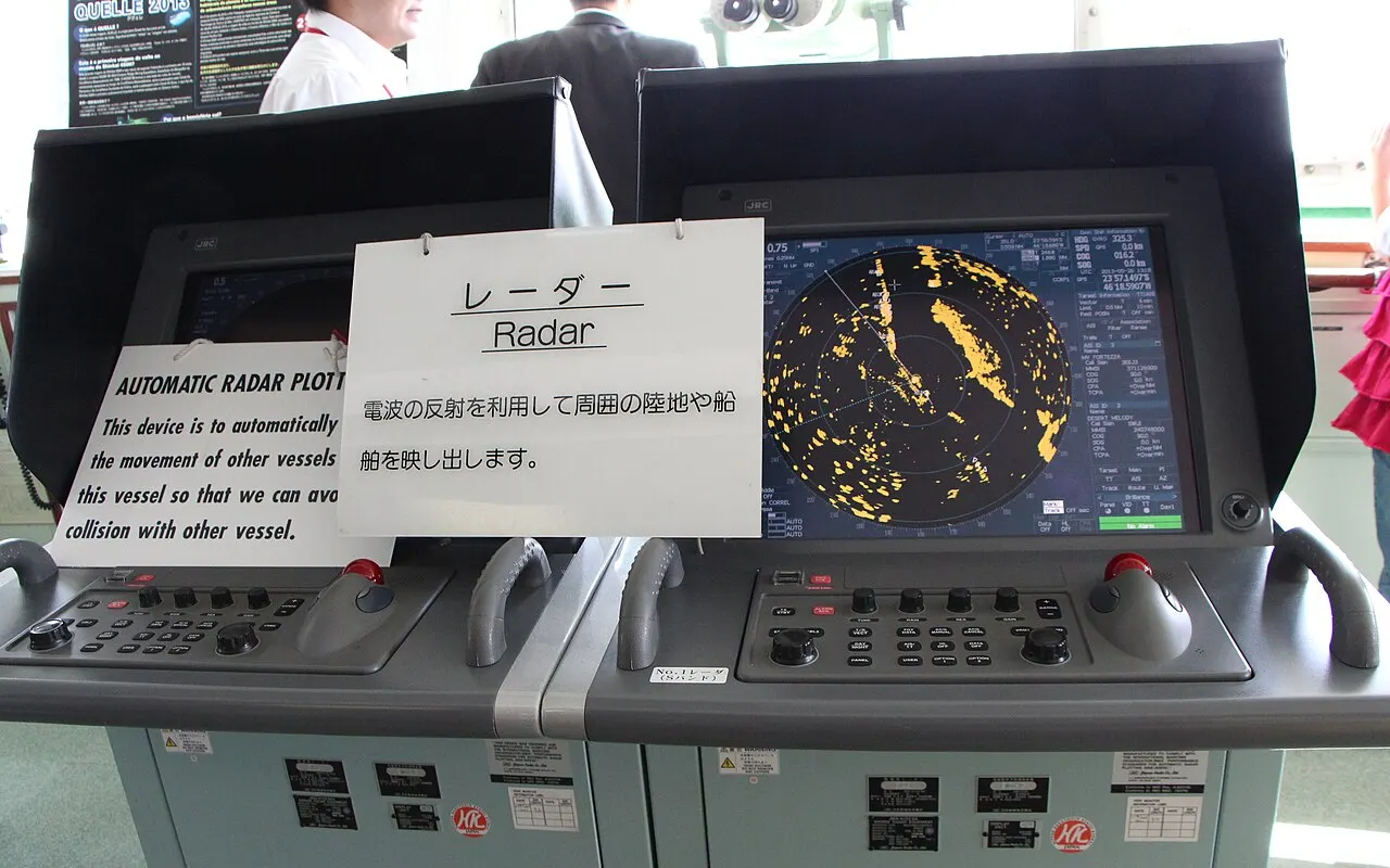
Reading the radar screen
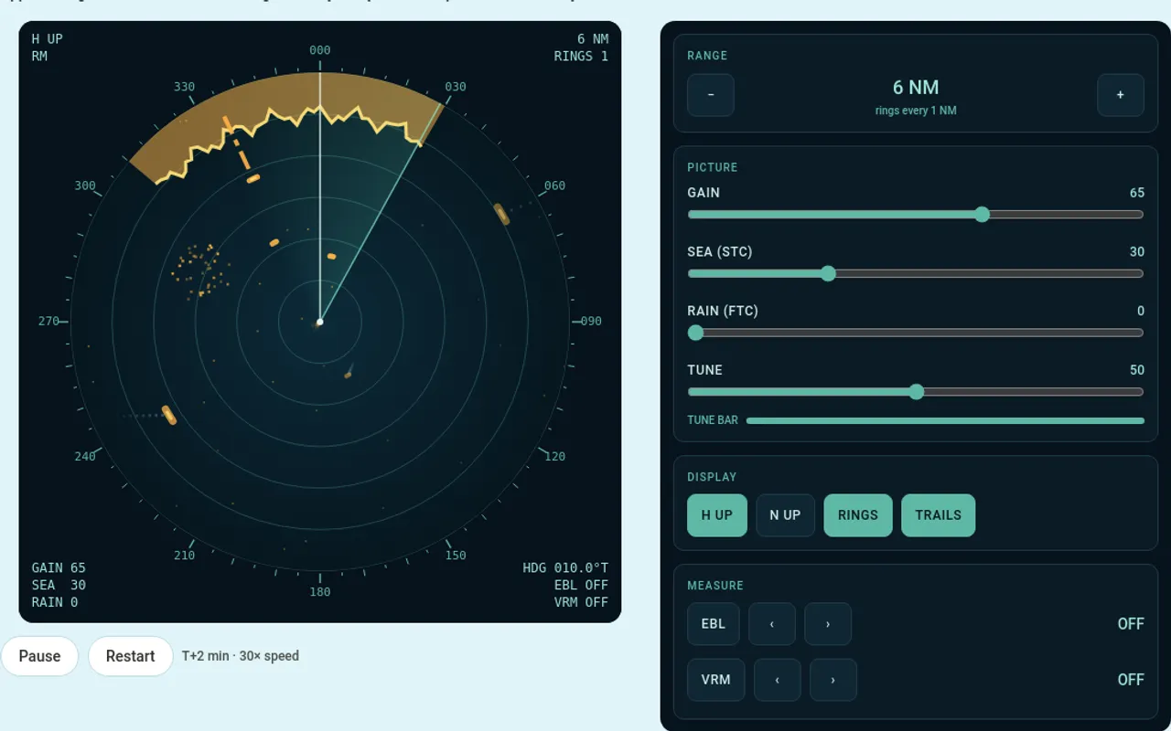
| Feature | What it tells you |
|---|---|
| Centre | Your own boat |
| Heading line | The direction your bow points |
| Range rings | Fixed distance circles; the spacing is shown in a corner |
| Bearing scale | Degrees round the edge: relative in head-up, true in north-up |
| H UP / N UP | The orientation: heading-up or north-up |
| EBL / VRM readouts | Your measured bearing and range |
How to set up a radar picture
- Switch on and wait for the warm-up, then select transmit.
- Range: choose 3 or 6 miles to start. The ring spacing changes with the range.
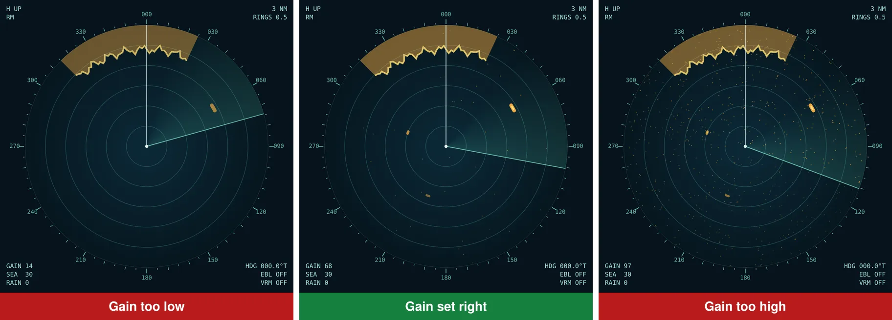
- Gain: increase until a faint speckle just appears over the screen, then back off slightly. Too little hides yachts; too much hides everything.
- Tune: adjust for the longest tune bar or strongest echoes (most modern sets tune automatically).
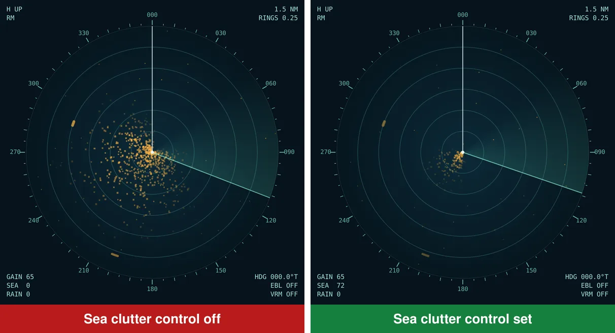
- Sea clutter (STC): increase until the wave echoes round the centre thin out, but no further. Overdone, it removes small boats close by.
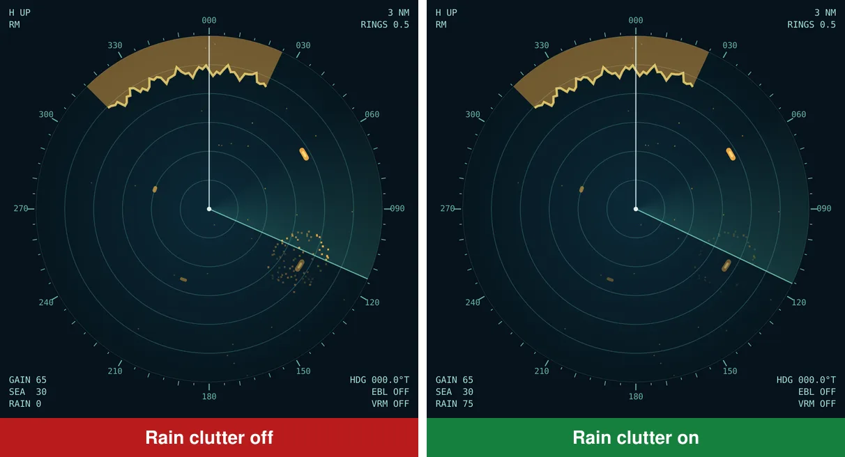
- Rain clutter (FTC): only when showers are on the screen. Turn it off afterwards.
Measuring range and bearing
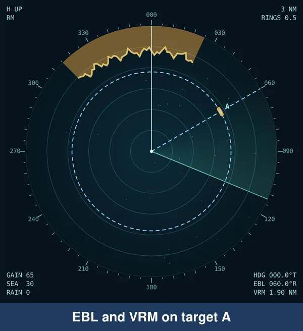
- VRM (variable range marker): lay the ring on the inner edge of the echo and read the range.
- EBL (electronic bearing line): swing it through the centre of the echo. In head-up the reading is relative to your bow; add your heading to get a true bearing.
- Radar range is more accurate than bearing. For a fix, prefer two or three radar ranges.
Head-up or north-up?
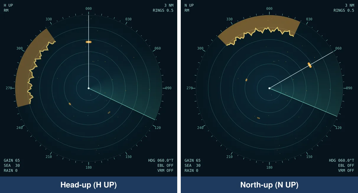
Head-up puts your heading at the top, matching the view from the helm: easy for collision avoidance. North-up matches the chart and gives true bearings directly: best for fixing your position and comparing coastlines. If your radar has a heading sensor, north-up stays stable while you steer.
How to tell if a ship is on a collision course
- Put the EBL on the target and the VRM on its range.
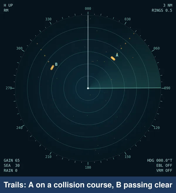
- Watch for 3 to 6 minutes. If the echo stays on the EBL while the range closes, the bearing is steady: risk of collision.
- Switch on trails. In relative motion, a trail pointing at the centre means a collision course; how far its extended line passes from the centre is the CPA (closest point of approach).
- In restricted visibility, Rule 19 applies: for a vessel detected by radar alone forward of the beam, avoid turning to port; a bold turn to starboard or slowing down is usually right.
Working out CPA and TCPA by hand
You don't need ARPA to judge the danger. Note the target's bearing and range twice, a few minutes apart.
| Time | Bearing | Range | What it tells you |
|---|---|---|---|
| 1200 | 030° | 4.0 miles | First observation |
| 1206 | 030° | 3.0 miles | Bearing steady, range closing 1 mile in 6 minutes |
| Result | Closing speed 10 knots; time to CPA about 18 minutes; CPA near zero: act now |
Plot the two positions on a plotting sheet: the line through them is the target's relative track, and its closest distance to the centre is the CPA. Keep plotting: every alteration either of you makes changes the answer.
How far can radar see?
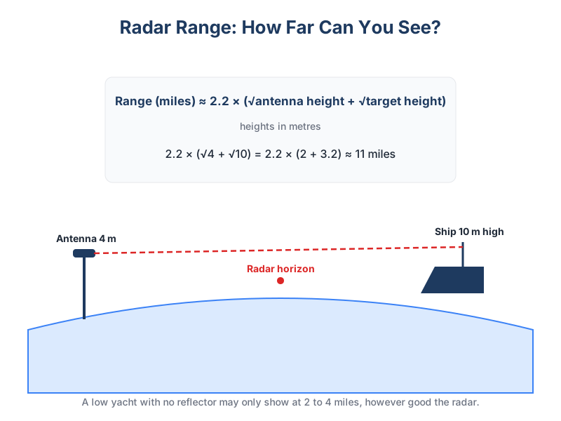
Radar waves travel in straight lines, bending only slightly round the Earth, so detection range depends on height. A good estimate in nautical miles is 2.2 × (√antenna height + √target height), with heights in metres. A 4 m antenna sees a 10 m high ship at about 11 miles, a 30 m cliff at about 16 miles, but a low yacht only within a few miles, and only if it reflects well.
Fixing your position by radar
- Choose two or three charted features that give clear echoes: steep headlands, breakwaters, isolated rocks. Avoid low, sloping beaches.
- Lay the VRM on each and note the range, quickly one after the other.
- On the chart, draw an arc of that radius round each feature. Where they cross is your fix.
- Check it against your depth sounder and GPS. Prefer ranges over radar bearings, which are less accurate.
Radar and AIS together
AIS shows ships' names, courses and speeds and works round headlands, but only for vessels that transmit (all large ships, many yachts, few fishing boats and almost no small craft). Radar shows everything that reflects, whether it transmits or not. Use both: AIS to identify and call a ship by name, radar to catch the targets AIS misses, and your eyes to check both.
Be seen: radar reflectors
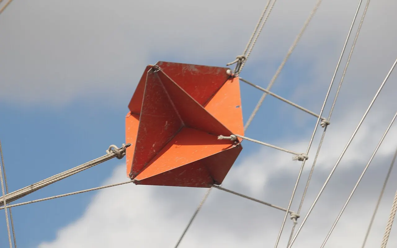
A yacht's own echo on a ship's radar can be tiny. A radar reflector mounted as high as possible makes you far more visible, and is required by SOLAS regulations for small craft where practicable. Active radar target enhancers (RTEs) give a stronger echo still. In fog, also sound your fog signal and consider an AIS transmitter.
What radar won't show you
- Small craft: GRP and wooden boats without a radar reflector may give weak or no echoes, especially in clutter.
- Targets in shadow: nothing behind land or a large ship.
- Very close targets: the minimum range and clutter can hide things within about 50 metres.
Radar never replaces a lookout (Rule 5). Combine it with AIS, your eyes and ears, and sound signals in fog. For more on fog, read fog at sea.